
Atlantic ZIP Code Directory Coverage
Atlantic County’s postal geography reaches far beyond a single city name. The list below uses codes found in county material and the associated post-office or area labels documented in the research. An area label is a practical postal clue, not a municipal boundary. When the research could not confirm a current local delivery footprint, the table says so instead of assigning a municipality by guesswork. Use a full-address USPS check before treating any entry as a delivery answer.
| ZIP | Areas covered | Post office | Research note |
|---|---|---|---|
| 08037 | Hammonton | Hammonton | Extends beyond a simple county or city concept in regional ZIP datasets. |
| 08094 | Atlantic County material includes the code | Verify by USPS | Exact local delivery label was not located. |
| 08201 | Absecon | Absecon | Verify the street-level boundary. |
| 08203 | Brigantine | Brigantine | Barrier-island city. |
| 08205 | Absecon and Galloway area | Commonly Absecon | Municipal boundary is not the ZIP boundary. |
| 08213 | Cologne | Cologne | Hamlet or post-office label in county records. |
| 08215 | Egg Harbor City | Egg Harbor City | Use municipality fields for parcel work. |
| 08217 | Elwood and Mullica area | Elwood | Postal label spans local geography. |
| 08220 | Leeds Point and Galloway area | Leeds Point | Postal label is not its own incorporated municipality. |
| 08221 | Linwood | Linwood | Verify an individual address with USPS. |
| 08225 | Northfield | Northfield | Verify an individual address with USPS. |
| 08231 | Oceanville and Galloway area | Oceanville | Postal label can differ from municipality. |
| 08232 | Pleasantville | Pleasantville | Use town and block/lot for official property work. |
| 08234 | Egg Harbor Township | Egg Harbor Township | Township name is the useful municipal control. |
| 08240 | Pomona and Galloway area | Pomona | Postal label is broader than a city-limit answer. |
| 08241 | Port Republic | Port Republic | Verify street-level delivery. |
| 08244 | Somers Point | Somers Point | Verify street-level delivery. |
| 08270 | County material includes the code | Verify by USPS | Current Atlantic delivery area was not located. |
| 08310 | Buena and nearby rural area | Buena | Includes Buena Borough context. |
| 08317 | Dorothy and Weymouth Township area | Dorothy | Postal label and township differ. |
| 08319 | Estell Manor | Estell Manor | Verify an address before using it for records. |
| 08326 | Landisville and Buena-area hamlet | Landisville | Postal label is a location clue. |
| 08330 | Mays Landing and Hamilton Township | Mays Landing | County seat uses a Mays Landing postal label within Hamilton Township. |
| 08332 | County material includes the code | Verify by USPS | Exact current Atlantic delivery area was not located. |
| 08340 | Milmay and Hamilton or Mullica area | Milmay | Postal label spans local geography. |
| 08341 | Minotola | Minotola | Buena Borough context. |
| 08342 | Mizpah and Hamilton Township area | Mizpah | Postal label differs from township. |
| 08346 | Newtonville and Hamilton Township area | Newtonville | Use town and parcel fields for official work. |
| 08350 | Richland and Buena Vista area | Richland | Postal label is not a city boundary. |
| 08401 | Atlantic City | Atlantic City | Standard delivery area. |
| 08402 | Margate City | Margate | Barrier-island municipal context. |
| 08403 | Longport | Longport | Barrier-island municipal context. |
| 08404 | Atlantic City | Verify by USPS | Special, PO-box, or delivery-use type was not confirmed in official text. |
| 08405 | Atlantic City and Federal Aviation entry | Verify by USPS | County records identify a unique institutional context. |
| 08406 | Ventnor City | Ventnor | Barrier-island municipal context. |
Codes should be read as delivery geography. The research did not retrieve a definitive USPS result table for every listed code, so the entries marked for USPS verification remain intentionally cautious.
Atlantic Postal Geography
Atlantic County has 23 incorporated municipalities spread across coastal or barrier-island communities, mainland suburban places, and inland townships and hamlets. One household or parcel may therefore move between a resort-city directory title, a township tax map, and a rural post-office label without leaving the county. Mays Landing is the clearest example: it is the county seat and a postal community, yet it lies within Hamilton Township. Cologne, Dorothy, Elwood, Leeds Point, Pomona, and other labels likewise help with delivery geography without creating a separate municipal jurisdiction.
That variation is useful when a name search or address record has a familiar postal label but no municipal match. Check the county’s official municipal directory for the jurisdiction, then use USPS for delivery. County deeds require the municipality in their legal descriptions. Assessment records rely on town and block/lot, while GIS relies on parcel geometry. A ZIP has a narrower role than any of those records.
Atlantic ZIP Code Directory USPS Checks
The USPS ZIP Code Lookup is the official verification step for a specific address. Enter the full address rather than relying on a city name or an old list. That can resolve whether a delivery route uses a postal community name that differs from the municipality used in tax, court, or deed records. It also avoids treating a post-office label as proof of a city line.
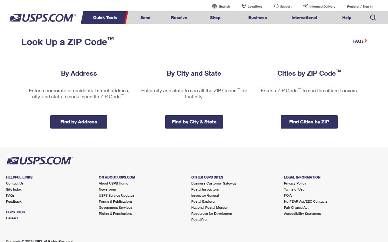
The USPS result validates a delivery ZIP for the entered address. Save it with the street spelling and date checked, then use municipal and parcel identifiers for record searches that need a legal location.
Historic research requires added care. A current ZIP does not prove an earlier postal name, municipal boundary, or street number. Preserve the original address from the source and search a normalized form separately.
Atlantic ZIP Code GIS Boundaries
For an area view, the Atlantic County GIS page links postal-boundary and tax-parcel data. It is stronger than the assessment hub for seeing how a postal area relates to roads and parcels. The county warns that GIS products are secondary maps and not survey-grade legal evidence, so use the viewer to orient a search and confirm parcel or title details in a recorded document.
The Census explanation of ZIP Code Tabulation Areas explains why a mapped ZCTA should not be mistaken for USPS delivery geography. ZCTAs are generalized areas based on 2020 census blocks, and not every valid ZIP is represented by one. A boundary can include blocks assigned by address majority rather than every route detail.
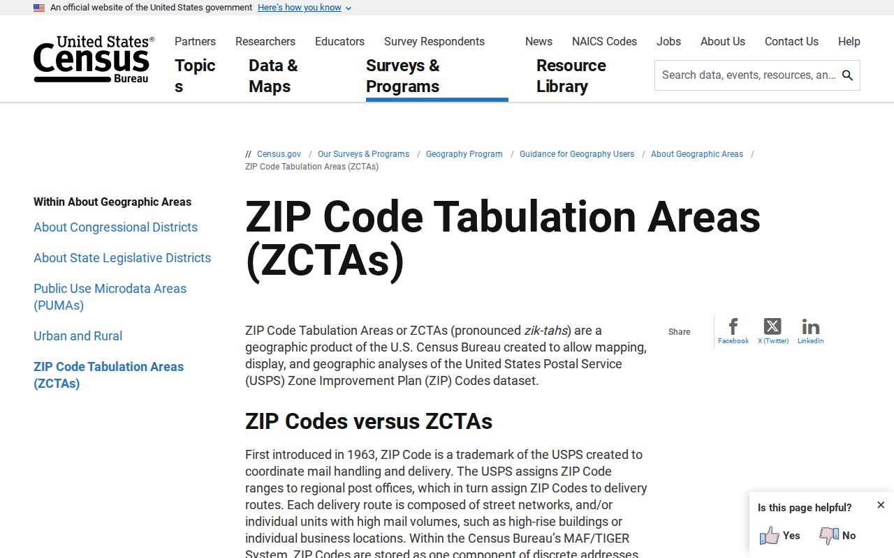
Use a ZCTA or GIS display for broad comparison, then return to USPS for delivery validation. The two sources answer related but different geographic questions.
Atlantic ZIP Code Search Fields
The Atlantic County Property Assessment Search Hub can narrow properties by municipal and parcel information, but the research did not document a visible ZIP filter. That means a ZIP-wide property search may need GIS parcel data, a municipal or address export, or a street-by-street approach after USPS validation. The table shows only the controls confirmed in the public interface, including the absence of a confirmed ZIP field.
| Assessment control | Type | ZIP use | Verified note |
|---|---|---|---|
| Town Filter | Municipality selector | Indirect | Use when a ZIP overlaps more than one town. |
| Property | Address or text | Indirect | Search a known street address after USPS validation. |
| B.L.Q. Filter | Compound text | No | Uses block, lot, and qualification identifiers. |
| Owner Name | Text | No | Useful after an address leads to an owner-of-record. |
| Class / Class4 | Dropdown | No | Property-class filters; live options were not exposed in text. |
| Sales Date and Price | Date or numeric filters | No | Narrows results by recorded sale information. |
| Building Sqft and Year Built | Numeric-range filters | No | Can separate similar address results. |
| ZIP field | Not visibly documented | Not confirmed | Do not assume the hub performs a ZIP-wide search. |
Note: A ZIP narrows delivery geography, while municipality plus block/lot remains the stronger property-record key.
Finding Residents by ZIP Code
A ZIP can organize a search, but it should not become the only filter. Start with an address that is already known, or use county GIS to see the parcel context. The official voter status tool is a one-person form rather than a ZIP-only batch search, and the assessment hub does not show a confirmed ZIP filter. That makes the workflow deliberately narrow and source-specific.
- Validate the full street address with USPS and preserve the returned postal label and ZIP.
- Open the County GIS ZIP-boundary and tax-parcel layers to identify the likely municipality and parcel area.
- Search the assessment hub using Town and Property, then record block/lot or other displayed parcel identifiers.
- Use the parcel clue in the Clerk’s land-record index when a deed, map, or legal description is needed.
- Check an individual voter’s status only through the official state route and only where permitted by New Jersey law.
Once a ZIP has narrowed the geography to one road or parcel, use the Atlantic street directory for the fuller address-to-parcel and deed-chain method. A ZIP cannot replace that street-level work.
Atlantic ZIP Code City Limits
ZIP boundaries and city limits do not describe the same thing. An 08330 address can be in Hamilton Township while using Mays Landing as its postal label. The 08205 label can span more than one municipality. Barrier-island postal areas such as 08401 and 08406 also do not settle every municipal-boundary question. For a legal or parcel search, use the municipality in the deed, the assessor’s town field, block/lot information, and GIS geometry instead of relying on ZIP alone.
New or changed situs addresses are a local coordination question. The research identifies county GIS and local planning, zoning, construction, clerk, or emergency-addressing staff as likely points of contact, but it did not locate one countywide E911 form or public conversion database. Parcel identifiers are the safer bridge when an old street number and current delivery label disagree.
Atlantic ZIP Code Directory Terms
Postal terms can look alike while serving different purposes. These definitions help keep a delivery lookup separate from census mapping and parcel research. They also explain why an address may have a correct ZIP but still need a municipality and legal description before it is searched in an official record.
- ZIP Code
- A USPS delivery-routing code used with an address. It is not a municipal boundary or parcel identifier.
- ZIP+4
- An added four-digit delivery segment that makes the postal code more specific than the basic five-digit ZIP.
- PO-box ZIP
- A code associated with post-office box service. Its exact type should be verified through USPS before it is described as a standard delivery area.
- Unique ZIP
- A ZIP used for a particular institution or special postal purpose. The Atlantic research flags 08405 for USPS confirmation in this context.
- Carrier route
- A USPS delivery grouping within a ZIP. It does not set property, municipal, or court-record boundaries.
The codes marked as uncertain in the coverage table stay uncertain by design. A precise USPS address result is needed before a special, PO-box, or unique ZIP is treated as a settled classification.
Atlantic ZIP Code Directory Record Limits
A postal area does not identify every person associated with it. Parcel data can identify an owner-of-record; a deed can document recorded parties; neither is a complete list of occupants. New Jersey’s Daniel’s Law can withhold covered home addresses and unpublished telephone numbers, and the Address Confidentiality Program can provide a substitute address for eligible participants. A missing person in an address-based record is not evidence that the person is absent from the area.
Use the smallest amount of identifying detail needed for a lawful question. Keep a source date and official URL, verify mismatches with the office that created the record, and never use address material to stalk, harass, intimidate, or harm anyone. The New Jersey Office of Information Privacy provides the Daniel’s Law route for eligible covered people.