
Atlantic Street Directory Address Steps
Atlantic County street research works best as an address chain. First, preserve the street number, directional, suffix, unit, municipality, ZIP, and post-office label exactly as supplied. Then make a second, normalized version for searching. That matters in Atlantic County because Mays Landing is a community within Hamilton Township, and a postal label is not proof of the municipality that maintains the parcel. The address can lead to an owner-of-record and a parcel, but it does not by itself establish who is currently present at the location.
- Search the Atlantic County Property Assessment Search Hub by property address and town. Save the displayed result date and data-import date.
- Use the Atlantic County GIS viewer to orient the parcel, tax-map sheet, and nearby road names.
- Carry the municipality and block/lot, when available, into the Clerk’s land-record index. An address alone is not a deed’s legal description.
- Search the current owner as grantee in the deed index, then the earlier seller as grantor. Compare the legal description and recording dates at every handoff.
- Use municipal code or construction records for address-specific events, and use printed address directories only as a historical lead that needs separate confirmation.
Each step narrows the next one. The sequence also keeps a street directory from confusing an owner, a mailing contact, and an actual household.
Atlantic Street Directory Property Filters
The Board of Taxation says its list books hold owner names, addresses, block and lot numbers, assessments, and sales information for county real-property parcels. The public assessment hub gives a street search useful starting controls, but the live text does not prove every item shown on a completed parcel card. Search by town first when a street name repeats. The Property field is the direct address route; B.L.Q. is the block, lot, and qualification route when a tax map has already supplied those identifiers.
| Hub control | Input | Required | Use in an address search |
|---|---|---|---|
| Town Filter | Municipality selector | Optional | Separates the same street name in different Atlantic municipalities. |
| Owner Name | Text | Optional | Checks an owner-of-record after the address search. |
| Property | Address or text | Optional | Primary field for a street and number. |
| B.L.Q. Filter | Compound text | Optional | Searches block, lot, and qualification. |
| Class / Class4 | Dropdown | Optional | Narrows by property class; live options were not exposed in text. |
| Sales Date | Date filter | Optional | Restricts results to a sale period. |
| Sales Price Range | Numeric pair | Optional | Limits results by recorded sale-price range. |
| Building Sqft Range | Numeric pair | Optional | Helps distinguish similar street-address results. |
| Year Built Range | Numeric pair | Optional | Another way to narrow a common address. |
| Sort / Download Excel | Control | Not applicable | Sorts results and offers export, subject to the displayed maximum-download notice. |
The hub documents wildcard behavior: an asterisk represents any number of characters, and a question mark represents one character. Start narrowly, then record exactly what the live result does and does not display rather than filling a missing parcel field from another source.
Note: A property result is a dated assessment record, not a complete list of people connected with the address.
Atlantic Street Directory GIS Route
The County GIS Office adds the map layer that a text result cannot provide. Its Web Map Viewer offers tax parcels, a data-table view, tax maps, ZIP Code Boundaries, 2022 aerials, downloadable data, and other map layers. Zoom to the street, select the target parcel, and note its parcel clue before moving to the next polygon. The municipal tax-map archive is especially useful when a street label has shifted or when the assessment search understands a parcel better than a street name.
GIS is an orientation tool, not a legal boundary decision. Atlantic County says its maps are secondary demonstration products, are not made to National Map Accuracy Standards, and are not surveyed for legal-boundary work. Confirm title, a legal description, and the recorded map through the Clerk before relying on a line or lot relationship. The county’s GIS staff phone listed in the research is (609) 645-5898.
Atlantic Street Records by Address
Several Atlantic County records can be keyed to an address or to the parcel behind it. They answer different questions. The assessment roll points to an owner and tax identifier; GIS locates the parcel; the deed index documents recorded parties and title events. Municipal files can add dated work or code information, but no countywide permit portal was located. That distinction matters when a street directory is used for family history, an estate question, or a property concern.
| Address record | Keeper | What it can show | Access route |
|---|---|---|---|
| Assessment list book | Board of Taxation or municipal assessor | Owner, address, block/lot, assessment, and sales; some live fields need result-level verification. | Property hub, municipal assessor, or OPRA for existing records. |
| GIS tax parcel | Atlantic County GIS | Parcel geometry, map layers, adjacent parcels, and ZIP-boundary context. | Public viewer, table, or downloads; disclaimer applies. |
| Recorded deed or mortgage | Atlantic County Clerk | Parties, legal description, consideration, recording date, book/page or file number, and linked documents. | Free index and available images; counter, State Archives, or FamilySearch fallback. |
| Tax map or plat | Clerk and Board of Taxation | Lot/block relationships, subdivision geometry, and map number. | Municipal tax-map archive and recorded-map index. |
| Permit or code file | Relevant municipality | Existing work, inspection, occupancy, demolition, or violation records tied to an address. | Municipal office or targeted OPRA request; no countywide portal located. |
| Property Alert | County Clerk and NewVision | Email match for a registered party name or municipality/block/lot after document verification. | Free subscription service. |
Use the parcel identifier as the bridge. A street name ties together the first search, but town, block, lot, qualification, and legal description are more stable when a lot is split, combined, or described under an earlier tract.
Atlantic Street Directory Deed Chain
Atlantic County Official Records Public Search, also called NewVision SearchNG, is the county’s free guest land-record index. It supports party name, second-party name, document type or group, date range, book and page, Clerk’s file number, consideration, legal search by town/lot/block, and map number. The instructions also describe an automatic trailing wildcard, ALL or ANY name logic, and linked documents. Search spelling variants because the Clerk cautions that names can be indexed inconsistently.
For an address trail, search the known owner as grantee and open the record’s details. The seller usually becomes the next grantor search. Include Linked Documents can surface related assignments or satisfactions without losing the current result list. A mortgage satisfaction may show that a debt ended, but it does not transfer title. Likewise, a tax-sale certificate or foreclosure filing is evidence of an event, not proof of occupancy or a completed transfer.
The Clerk’s recording-fee schedule is a useful check on the instruments handled in this system, including deeds, mortgages, liens, maps, UCC filings, and tax-sale certificates.
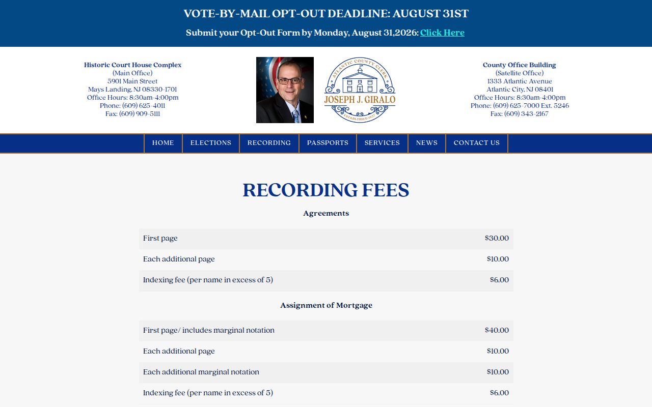
The fee page belongs beside the index as a custodian source, not as a shortcut around record verification. Check the current schedule before quoting a fee or ordering a paper record.
Atlantic Street Map Scan Numbers
Atlantic County’s historical street trail is stronger than a simple online-image cutoff suggests. The Clerk reports completed preservation work for more than 9,500 recorded maps and tax maps, all 414 index books, and Atlantic County Record newspaper material from 1864 through 1967. Public images are stated from March 1, 2000, while older items continue to be back-scanned and deed-book scanning continues. A no-image result is therefore an access limit, not proof the historical record disappeared.
When a web result has no image, use the Clerk’s records room, index books, tax-map archive, State Archives microfilm, or FamilySearch collection named by the research. The State Archives describes Atlantic County deeds on microfilm through 1900 and county mortgage material through 1850. Keep the book, page, file number, municipality, and legal description with the search notes so a counter request has a precise target.
Atlantic Street Directory Address Terms
Address records use several labels for the same place. Reading those labels correctly prevents a common mistake: treating an outside mailing contact as proof that the person occupies the parcel. A post-office name can also differ from the municipality. In Atlantic County, Mays Landing can be the postal label while Hamilton Township is the municipal label used in a deed or tax search.
- Parcel
- A specific piece of taxable land, commonly tracked through a municipality and block/lot or qualification identifier.
- Situs address
- The physical location of the parcel. It is different from a mailing address used for tax notices or correspondence.
- Plat or tax map
- A map showing lot, block, subdivision, or related parcel information. It should be compared with the recorded legal description.
- Criss-cross directory
- A historical address arrangement that can lead from a street and number to a printed name, subject to the year and coverage of that volume.
For earlier address work, historical directories can supply a lead, not title proof. The Atlantic city directory collections provide the fuller historical-shelf context when a printed address needs to be compared across years.
Note: Keep the original spelling and a normalized search form because street suffixes, postal labels, and municipal names can differ.
Atlantic Street Permit Records
Municipal construction and code files can add dates that a deed chain does not show. Ask the responsible municipal office for an existing permit index, applications, inspection or final approvals, certificates of occupancy, zoning approvals, unsafe-structure notices, demolition records, and violation cases for a normalized address, block/lot, and date range. Identify the person or entity exactly as the record labels them. An applicant, agent, contractor, or complainant is not automatically the owner.
No countywide permit portal or uniform retention schedule was documented. When an office reports an archived or unavailable record, preserve that response. A written request under the New Jersey Open Public Records Act (OPRA) can seek existing municipal or county records, but it does not require an agency to create a new street roster or compile a person-centered answer.
Atlantic Street Directory Voter Limits
Voter material is not a public street-by-street household census. New Jersey’s public voter-list rules can make certain registration-list fields available through the statutory route, while the live Am I Registered? tool is a one-person status check rather than a bulk street map. Protected addresses are excluded, and nonregistered, inactive, moved, or protected people will not appear as a one-to-one match with parcels.
Use a parcel record to identify the correct municipality and address format, then use a voter route only where the law permits and the purpose is lawful. Do not interpret a missing match as evidence that no one is connected to the address.
Atlantic Street Directory Privacy Limits
Public parcel and deed records are not a complete household list. They generally do not reveal every non-owner occupant, child, utility customer, delivery recipient, or motor-vehicle address. New Jersey’s Daniel’s Law can protect covered home addresses and unpublished telephone numbers, and the Address Confidentiality Program can let eligible participants use a substitute address in new state and local government records. A protected person may be absent from an address lookup or appear with a substitute mailing address.
Correct a property-field error through the assessor or municipal clerk, an instrument-index concern through the County Clerk, and a voter-record concern through the Superintendent. The office that created the record is the right place to verify it.